

Establishing electronic safety zones, warning vessels from entering secure areas according to Decree 143 and related provisions:
– Article 14 of Decree 14/2014/ND-CP specifies the protective corridors for underwater electric cables as follows: The width of the corridor is limited by two vertical planes at a distance from the outer surface of the cable sheath or the outer cable strands on either side of the underwater cable. For cables laid directly in the ground, the width of the corridor where vessels may pass is 100 meters. Anchoring within this protective corridor for the underwater cable is strictly prohibited.
– Article 8 of the Petroleum Law No. 12/2022: The anchoring prohibition area or activities taking place on the seabed is defined within a range of 2 nautical miles from the outer edge of the oil and gas structures, including any underwater installations; vessels are not allowed to anchor or conduct seabed activities, except in special cases approved by the contractor or decided by the Prime Minister.
Eyesea Technology Joint Stock Company (Eyesea) provides a solution for monitoring vessels in the areas of pipelines and underwater cables, designed to protect these infrastructures from damage caused by the movement, anchoring, or fishing nets of marine vessels by creating virtual boundaries displayed on AIS-equipped devices on each ship. Alerts will be triggered whenever a vessel approaches the cable or pipeline area.
Through AIS data sent from dredging vessels displayed on a digital map, customers can quickly and accurately access information about the vessels, including location (longitude, latitude), speed, direction, and other identification details.
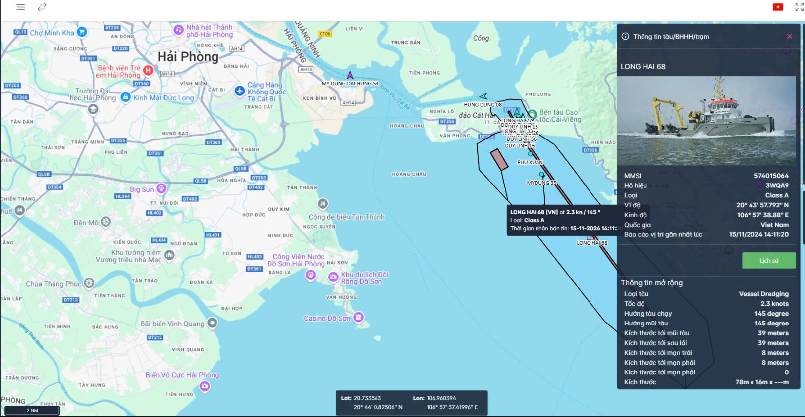
Key functions of the AIS Management and Information Extraction System include
- Management of dredging areas and construction plans.
- Real-time monitoring of dredging activities: Displaying the location, information, and status of dredging vessels and other ships in the area on a map interface.
- Generating daily work logs for each dredging vessel, showing the entire activity of the vessel for the day
- Extracting the historical location data of the dredging vessels (Location, speed, AIS signal strength, etc.)
- Playback of a vessel's journey
- Alerts when a vessel exits the dredging area or when AIS signals are not received from the vessel.
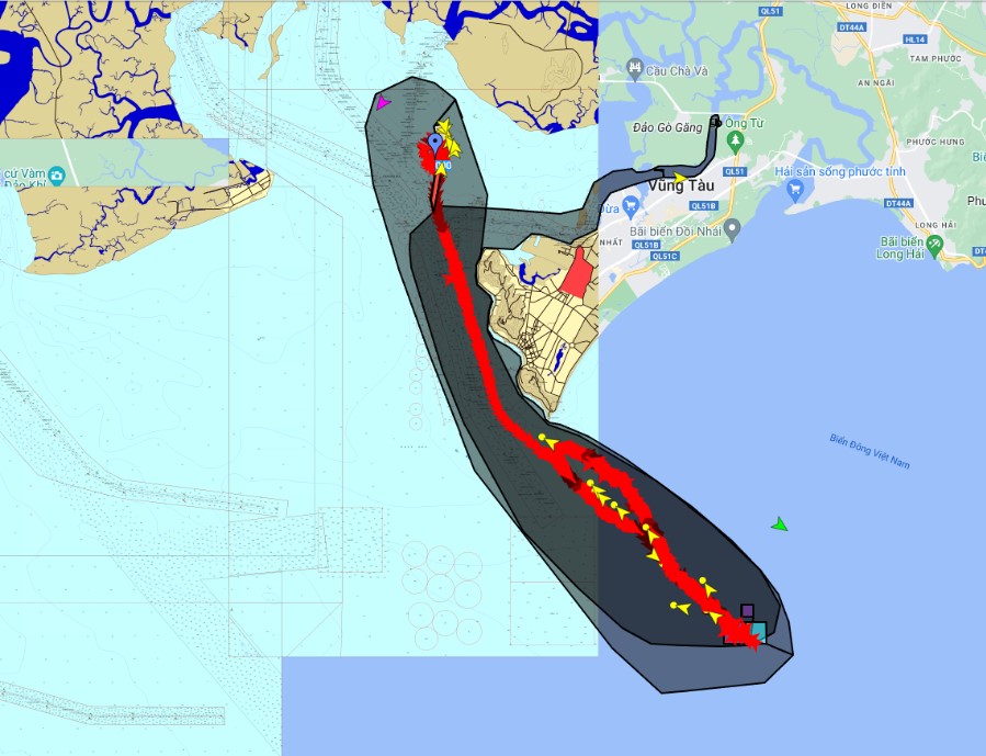
With the advantage of continuously updated vessel information in a short time frame, management agencies can fully track the vessel’s journey in near real-time. The AIS data from dredging vessels is stored by Eyesea for a period of three years at the data center.