Establishing electronic safety zones, warning vessels from entering secure areas according to Decree 143 and related provisions:
- Article 14 of Decree 14/2014/ND-CP specifies the protective corridors for underwater electric cables as follows: The width of the corridor is limited by two vertical planes at a distance from the outer surface of the cable sheath or the outer cable strands on either side of the underwater cable. For cables laid directly in the ground, the width of the corridor where vessels may pass is 100 meters. Anchoring within this protective corridor for the underwater cable is strictly prohibited.
- Article 8 of the Petroleum Law No. 12/2022: The anchoring prohibition area or activities taking place on the seabed is defined within a range of 2 nautical miles from the outer edge of the oil and gas structures, including any underwater installations; vessels are not allowed to anchor or conduct seabed activities, except in special cases approved by the contractor or decided by the Prime Minister.
Eyesea Technology Joint Stock Company (Eyesea) provides a solution for monitoring vessels in the areas of pipelines and underwater cables, designed to protect these infrastructures from damage caused by the movement, anchoring, or fishing nets of marine vessels by creating virtual boundaries displayed on AIS-equipped devices on each ship. Alerts will be triggered whenever a vessel approaches the cable or pipeline area.
The system includes the following functionalities:
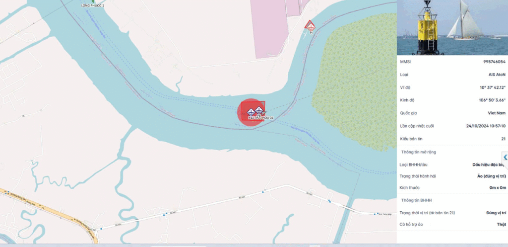
- Establishing virtual AIS signals to warn of the underwater cable areas.
- Displaying a base map: In the form of electronic navigational charts (ENC) on the Google map background, including all layers according to S57 or S63 standards.
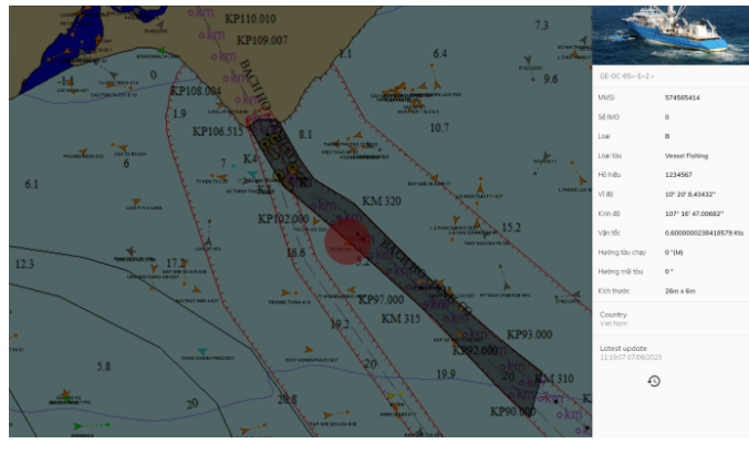
- Displaying the position and status information of vessels in the area in real-time.
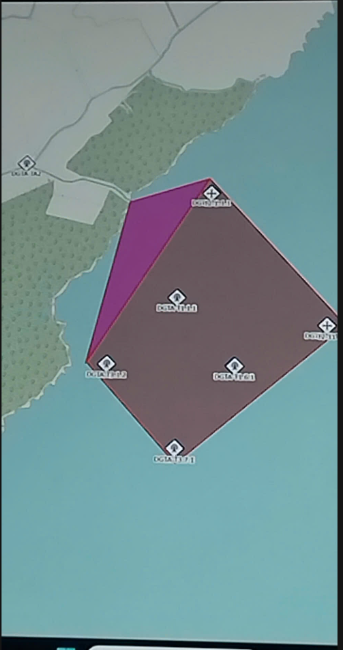
- Marking the no-anchor zone within 2 nautical miles around the underwater oil and gas pipeline area or 100 meters for underwater cables.
- Online monitoring of maritime activities: Displaying the position, information, and status of vessels participating in maritime activities, reflecting the entire vessel operation.
- Alerts when vessels move into dangerous areas
- Alerts when vessels stop or anchor in areas with underwater cables.
- Generating specialized reports weekly, monthly, and annually.
- Playback of a vessel’s journey with a user-friendly interface.
Projects implementing this solution include:
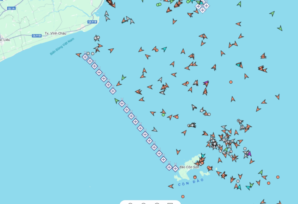
Warning and marking system for the electrical path to Con Dao.
Protection system for the Southeast Gas Pipeline PVGAS
Dredging projects, Nhon Trach 3 and 4 Power Plants. LNG Vung Tau – Thi Vai
Wind power projects in Tan An, Tan Phu Dong, Duyen Hai, Ca Mau 1A-1B-1C-1D, VPL… Offshore wind power in Ben Tre (MeanStream)