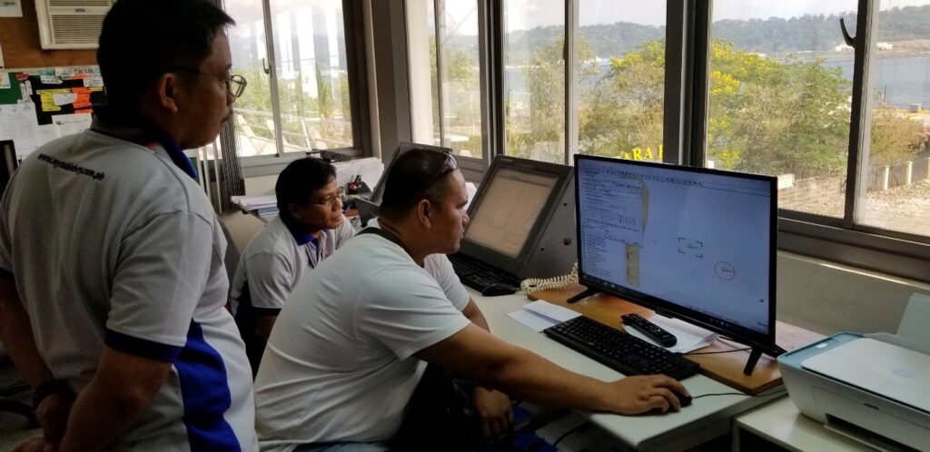
Developing remote monitoring and management software for maritime signaling based on data from the Automatic Identification System (AIS) and Electronic Navigational Charts (ENC).
The management and monitoring of maritime signaling require extensive information and continuous activity to ensure safe navigation. Therefore, signaling devices must always be monitored and managed. To oversee maritime signals and the activities of vessels, various methods can be employed, including direct operation by personnel, sensors, or remote monitoring through automatic identification signals. Based on data from the Automatic Identification System (AIS) and Electronic Navigational Charts (ENC), Eyesea has researched and developed software for remote monitoring and management of maritime signaling via the Internet. This software addresses the challenges of tracking maritime signals and supervising vessel operations remotely through computer applications.
Overview of the Automatic Identification System (AIS)
AIS is an automatic identification system operating on the VHF maritime frequency band, used to recognize information between vessels and entities equipped with AIS devices within VHF coverage. AIS data aids in managing maritime operations, controlling maritime signals, and preventing collisions between vessels. It can also exchange information for assistance during incidents and provide weather information. When combined with other communication devices, AIS is deployed in emergency situations, rescue operations, allowing vessels to actively share their information with nearby vessels, coastal radio stations, VTS (Vessel Traffic Service), and maritime authorities. The AIS automatically records information about vessels, crew, and cargo. Installing AIS equipment not only serves state management but also enables ship owners and operators to observe and communicate with surrounding vessels. In emergencies, such as sinking, locating the position becomes much easier, facilitating rescue efforts.
Overview of Electronic Navigational Charts (ENC)
Electronic Navigational Charts (ENC) are vector maps containing all standardized technical data, structures, and formats. ENCs hold the necessary information for safe vessel navigation and provide navigators with maps and maritime information visually displayed on computer screens. ENCs are widely used in various fields, including:
– In signaling management: Utilizing specialized software to display electronic navigational charts combined with AIS reception devices to verify the positions and operational status of maritime signals.
– Updating and storing navigational signal information and shipping routes.
– In navigation: Electronic navigational charts serve as a foundation for the ECDIS (Electronic Chart Display and Information System), which integrates AIS, Radar, etc., allowing for object selection and display scale adjustment.
· Maritime Management Authorities: ENC is used as the foundation for the ECDIS (integrating AIS and VTS) in managing vessels operating within the designated area of responsibility.
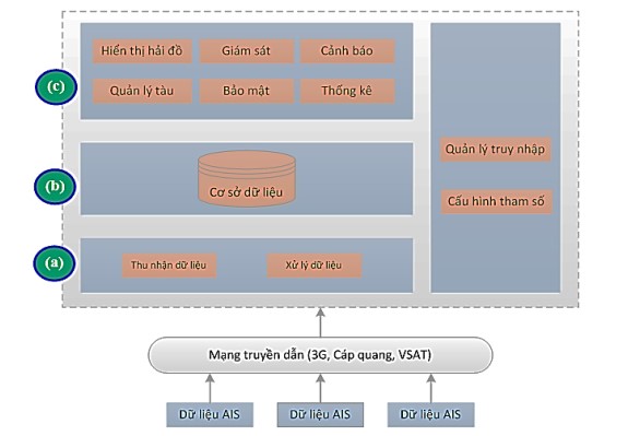
The software collects signaling data (location, status of signals, voltage, etc.); meteorological and hydrological information from tidal recording stations (wind information, water level, etc.); static data of vessels (callsigns, vessel names, dimensions, cargo types, etc.); and data on location, movement direction, speed, estimated arrival time, destination port, and other information through AIS transmission sources.
From this data, the software processing unit uses complex algorithms combined with maritime operational techniques to generate useful and systematic information for users. Users can monitor the operational status of signals, the behavior of individual vessels or groups of vessels, and set alerts related to specific vessels. The exploitation unit provides an interface for users to monitor objects on maps and perform operational tasks easily and effectively through the software interface.